To main content

Channel expansion, Suez

The Suez Canal is one of the world’s main shipping links and thus of major importance to world trade. The canal extends from Suez on the Red Sea to Port Said on the Mediterranean. Egypt’s Suez Canal Authority awarded the contract to double the canal’s capacity to a consortium, which was aptly named the Challenge Consortium by the Chairman of the Suez Canal Authority, Admiral Mohab Mamish.

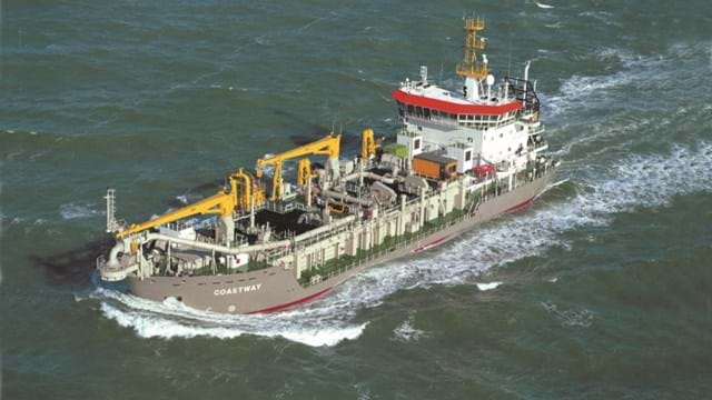
The consortium comprising Boskalis, Van Oord, NMDC (Abu Dhabi) and Jan de Nul (Belgium) had the task of dredging the 35 km long New Suez Canal parallel to the existing canal. This involved dredging a record breaking 200 million m3 of sand, clay and rock in less than 9 months. In addition, two Service Channels (80 m wide and design depth -10 m CD) and two Cross Channels (50 m wide and design depth of -6 m CD) were dredged to connect the existing canal and the New Suez Canal.

Enormous scale

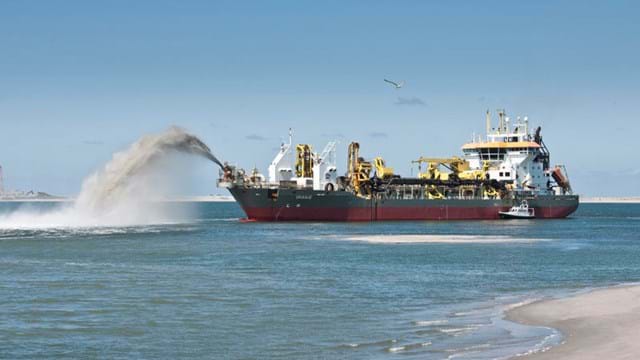
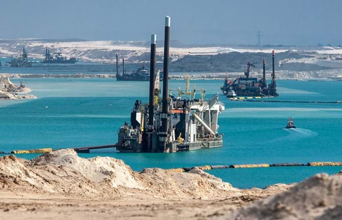
Dredging 200 million m3 of material in a period of 9 months required the deployment of the world’s largest dredging fleet comprising 21 Cutter Suction Dredgers, 5 Trailing Suction Hopper Dredgers and 2 Water Injection Dredgers. The dredging vessels cut the capital volume and pumped the mixture of soil and water into 16 disposal basins totaling an area of 73 million m2. This required a total length of 85 km floating and shore pipeline.

Complex planning

To ensure the project was completed on time, the fleet of vessels had to be managed to achieve optimum production levels. The first planning task was to enable as many vessels as possible to dredge simultaneously. This required breaking in at both ends of the New Suez Canal and at four points along the existing canal to create ten fronts for the dredging vessels at an early stage in the project.

Logistics

The project was a major challenge in logistics and could have been a project on its own on managing the logistics of incoming shipments arriving on their own keel, by semi-submersible vessels, cargo vessels, and regular air freight, sea freight and road transport.

Time pressure

The main challenge for the Consortium was the time frame in which all dredging had to be completed. A project of this scale was initially estimated to take three years to complete, but the President of Egypt had set the limit for completion at one year. The period from tender to contract award was only one month, and dredging started within a month. The New Suez Canal was open for shipping in just five days after completion of the dredging works.

Facts and figures

  • 35 km long canal with bottom width 147 to 177 m and design depth -24 m CD
  • 2 Service Channels (width 80 m and design depth -10 m CD), and 2 Cross Channels (width 50 m and design depth -6 m CD)
  • 9 months execution period including preparations
  • 28 dredgers on site including 21 Cutter Suction Dredgers, 5 Trailing Suction Hopper Dredgers and 2 Water Injection Dredgers
  • 85 km soil conveying pipeline (floating and shore pipeline)
  • 16 disposal basins located on the east and west banks of the New Suez Canal
  • Approximately 2,000 people from 45 countries employed on site; over 4.5 million man-hours, over 3,700 project safety inductions, and no fatal injuries or permanent disabilities
  • The New Suez Canal was opened for shipping on 6 August 2015, 5 days after completion of dredging
  • Extension of time was not possible

Related projects

Selected filters
Newbiggin_header.jpg

Beach replenishment, Newbiggin Bay

Newbiggin by the Sea was once a seaside resort, with the residential area focused around the bay. The beach has severely eroded over the years. If the coastline would continue to recede, sea walls could begin to collapse, imperilling coastline properties. The falling beach levels and increased risk of seawall failure led to a strategy and proposal to import beach fill, along with construction of an offshore breakwater to retain material. Boskalis expanded the existing beach and protected it from erosion.

AA_hoofdfoto_header.jpg

Dredging, reclamation,
reconstruction and environmental
monitoring works, Vilufushi

The Republic of the Maldives consists of 1,190 small coral islands grouped into 26 atolls. Only 200 islands are inhabited. On 26 December 2004, a tsunami originating from Indonesian waters struck the Maldives. This natural disaster had major economic, social and environmental consequences. Of the 200 inhabited islands, 13 were totally destroyed and 56 suffered major damage, including the island of Vilufushi in Thaa Atoll. Houses and infrastructure were heavily damaged. All the surviving residents had to be evacuated to the neighboring island of Buruni to the west of Vilufushi. The government of the Maldives decided to reconstruct the entire island and to extend it considerably by landfilling the shallow reef. Boskalis International was appointed for this work.

_DSF0040_header.jpg

Removal of overburden for bauxite mine, Klaverblad

Surinam’s alumina exports accounted for 70% of the total export figures. Aluminum is produced from bauxite and so bauxite mining was one of the country's vital industries. Growing demand for metals in fast-growing economies led BHP Billiton Maatschappij to open up a fourth mine alongside the three bauxite mines they already operated in Surinam. The mine location on the banks of the River Surinam was covered by a thick layer of clay. Borehole information and surveys showed that an area of about 130 ha needed to be cleared of bush, followed by the removal of the top layer and dewatering to an average depth of 14 meters. Safety and the prevention of dredging-related turbidity in the river were areas requiring particular attention.

Beachway_2002_67_header.jpg

Maintenance, Martin Garcia channel

The Rio Parana is the principal fairway for transporting the massive exports of agricultural products from the fertile plains of Argentina, Bolivia and Paraguay. Ocean going vessels sail the Parana River to the loading terminals in the Rosario region, situated 300 km upstream from the Rio de La Plata estuary. Both the Rio Parana and the Rio Uruguay flow into the Rio de la Plata. The Rio de la Plata can be described as a shallow inland-sea with natural depths between 1 and 6 m. The mouth of the Rio Parana from the Ocean is approximately 250 km. The Rio de la Plata has a width of 40 km on the upstream side near Buenos Aires and about 200 km downstream at the level of Montevideo.

Picture2_header.jpg

Dredging, reclamation and dewatering works, Gas-to-Liquids facility Escravos

The Escravos Gas-to-Liquids facility (EGTL) converts natural gas feed into high quality, environmentally superior, liquid GTL fuel, naphtha, and LPG products. The facility feed is approximately 320 million SCFD of natural gas and the facility produces approximately 33,000 BPD of products. The EGTL facility will be built on the north bank of the Escravos River tidal outlet, in the Niger Delta about 2 kilometers north of its confluence with the Atlantic Ocean on the Bight of Benin, approximately 100 nautical miles south east of Lagos, and 37 nautical miles west of Warri, Nigeria.

2007-02-22_header.jpg

Land reclamation, Half Moon Bay Island Manama

‘Half Moon Bay’ island is situated in the Seef area of Manama in the Kingdom of Bahrain. The purpose of the island is to accommodate a future 5 Star Hotel development as well as several villas. Engineering Department Hydronamic was engaged to develop the design of the island and to provide advisory services to Boskalis Westminster Middle East. Through good co-operation between the design engineers of Hydronamic and the construction team of Boskalis Westminster Middle East innovative ideas were developed which could be integrated into the rock protection design resulting in the successful and efficient construction with significant cost savings to the project.