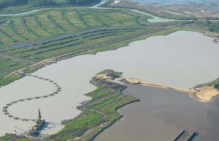
Surinam’s alumina exports accounted for 70% of the total export figures. Aluminum is produced from bauxite and so bauxite mining was one of the country's vital industries. Growing demand for metals in fast-growing economies led BHP Billiton Maatschappij to open up a fourth mine alongside the three bauxite mines they already operated in Surinam. The mine location on the banks of the River Surinam was covered by a thick layer of clay. Borehole information and surveys showed that an area of about 130 ha needed to be cleared of bush, followed by the removal of the top layer and dewatering to an average depth of 14 meters. Safety and the prevention of dredging-related turbidity in the river were areas requiring particular attention.
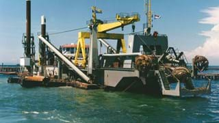
Nearly the whole site was covered with secondary bush. So the first stage of the operation started in November 2004 with bush-clearing and shredding. The shreds were spread over the top layer and their dimensions were such that they could be dredged hydraulically without clogging the pumping system. Meanwhile, the clamshell dredger Elisa started digging a ring channel, an access channel and an initial pit for the CSD Edax. The ring channel was also constructed as a levee to enclose the dewatering site and prevent flooding of the nature in the vicinity. The Edax commenced dredging in July 2005 and her output was pumped into a disposal site near the old Rorac mine. The process water could not be discharged into the river and so it was pumped 12 kilometers to the old Para Mine with the booster stations Nieuwe Merwede and Energie III. In the meantime, the TSHDs Gemma and Flevo brought in river sand for the construction of a cofferdam that, in combination with the levees, completed the total enclosure of the mine. The heavy rains meant that extra sand had to be brought in to strengthen roads and other critical points at different locations on the site. Dewatering of the mine started in August 2006, with the water being taken to the settlement locations to prevent turbidity in the river. Edax stopped dredging a few weeks later.