To main content

Creation bird island, Le Havre port 2000

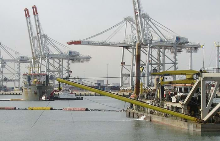
Le Havre is the fifth largest container port in Europe and is expanding its facilities: the current 14 quays for container vessels are to be expanded with another 12 (all outside the locks). Port 2000’s rationale centres on Le Havre’s determination to position itself as a leading hub.

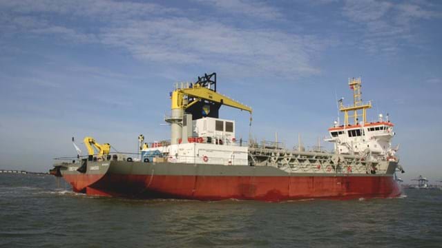
The Cutter Suction Dredgers Haarlem and Cyrus were deployed to execute the works. The Haarlem first dredged the top layer (mainly sand). The Cyrus took over for the rougher gravel part. Cyrus began by dredging for the new berths. The dredging required for Berths 1 and 2 was completed in July. The big cutter dredger then switched to the eastern port area and dredged Berths 3 and 4. Work then continued on dredging the turning basin. The berths were being dredged to -15.5 m. and the turning basin to -16.0 m. The dredged material was pumped into three reclamation areas, with a pumping distance varying between 2 km for the gravel and 4.5 km for the sand.

Creation of a bird island

Part of the environmental compensation measures for the Port 2000 project was the creation of  'Ilot Reposoir', an island that will serve as a bird habitat. Ilot Reposoir was constructed south of the Le Havre port extension, on a sandbank called 'Banc du Ratier' which is situated on the opposite side of the river Seine and the access channel to the ports of Honfleur and Rouen. The island has a complex geometry, but in general it can be described as an oval with an opening in the southern side. In size it measures 200 m from the north to the south and 325 m from the east to the west. Various requirements were imposed on the design. For example, the estuary currents should not be affected, the island had to be strong enough to withstand storms, and in particular the island had to meet the needs of its bird populations, especially those of the tern, which is an endangered species. The first phase of the project consisted of constructing a dike of armourstone along the future outline of the island with the Arca. The island was reclaimed with dredged material (sand and gravel) from the approach channel to Le Havre port.
Related projects

Selected filters
IMG_8772_header.jpg

Coastal protection, St. Petersburg

St. Petersburg is a UNESCO World Heritage City, but its location along the River Neva means that it has been threatened by over 300 floods since its founding by Peter the Great in 1703. The completion of the new 25 km long storm-surge barrier across the Gulf of Finland ensures that the city will no longer be vulnerable to high tides and devastating floods. As a result of the new Flood Protection Barrier, however, the old winding access channel had to be replaced with a new, straighter, more easily navigable channel.

Delflandse_coast___3__header.jpg

Coastal protection, Delfland coast

In August 2008 Van Oord and Royal Boskalis Westminster N.V. have been awarded a contract by the Dutch Directorate General for Public Works and Water Management to reinforce a weak link in the Delflandse coast . The contract is worth EUR 120 million of which Van Oord and Boskalis have an equal share.

IMG_1888_header.jpg

Cleanup, Zellingwijk area

The Zellingwijk quarter of the village of Gouderak was built in the middle of the last century. In the early 1980s it became clear that the soil underneath this residential area was heavily contaminated as a result of the dumping of waste - mainly mineral oils and pesticides. The homes built on the site were subsequently demolished in the mid-1980s. Pending definitive remediation work, a layer of concrete / asphalt was applied to seal the site.

DSCF0279_header.jpg

Overview activities, Bahrain

The Kingdom of Bahrain is an island located in the Gulf, east of Saudi Arabia and north of Qatar and connected with its neighbour Saudi Arabia since the year 1980 with a 25 km long causeway. The archipelago consists of some 30 islands with a total of 160 km of shoreline and has a population of 800,000. Whereas the surface of Bahrain in the year 1960 was around 650 km2, the last decennia have seen a steady increase in the surface till a respectable figure of 740 km2 in 2007. This increase has been achieved by a various number of small and mayor reclamation projects.

37ac96e429c252fd55f1136ce6374c9e_image_header.jpg

Early works for LNG plant, Brass Island

The Brass LNG Project’s objective is to construct a LNG Complex on Brass Island, Bayelsa State, Nigeria, and in so doing, develop Nigeria’s abundant gas resources, reduce the adverse effect of gas flaring on the environment, and provide social-economic benefits to the local and wider Nigerian communities. The LNG complex will be designed to produce approximately 10 million tons per annum (MTPA) of LNG, as well as LPG and Residual NGL products.

IMG_0619_header.jpg

Port expansion, Gijón

The Spanish port of Gijón on the Bay of Biscay processes more than 12 million tonnes of bulk goods annually. With the expansion of global trade and increasing ship sizes, the terminal was lacking capacity to handle the traffic. The maximum draft for the ships of 18 meters is another obstacle to the development of the port. So the Port Authority of Gijón developed a plan for additional modern facilities in an area measuring 145 hectares to the north of the existing port. This includes a bulk terminal with a transfer capacity of more than 25 million tons and a storage area measuring 60 hectares for a maximum of 2 million tons of coal and iron ore a year.