To main content

Port development, Tanger Med 2

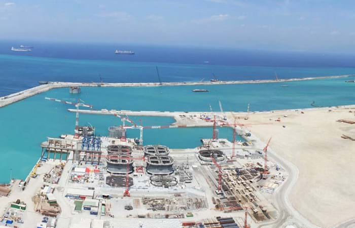
Tanger-Med is a cargo and passenger port located about 40 km east of Tangiers, Morocco, on the Straits of Gibraltar at the crossing of two major maritime routes only 15 km from the European mainland.

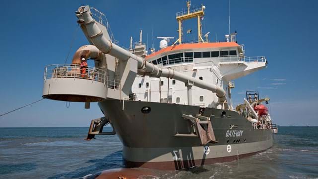
The port consists of the Tanger Med 1 terminal, which went into service in 2007, a ferry terminal (2009), and the Tanger Med 2 port, which has been under construction since March 2010 and is scheduled to be completed by 2015/2016. At full capacity, the port is expected to handle 8 million containers, 7 million passengers, 700,000 trucks, 2 million vehicles, and 10 million MT of oil products. The Tanger Med 2 extension project was implemented, coordinated and managed by TMSA, a private company with public prerogatives operating under an agreement with the Moroccan State and interacting with the different ministries involved. The Tanger Med 2 port facilities will eventually include two new container terminals with a total length of 2,800 m and an additional nominal capacity of 5 million containers. The first phase is currently nearing completion, with the breakwaters and 1,200 m of quay wall in place. The expansion works for Tanger Med 2 are being executed by a consortium consisting of BSTM (BESIX-SOMAGEC) and TMBYS. In this consortium, BSTM is responsible for the quay and future storage areas and TMBYS is building the breakwaters. Boskalis International worked as a subcontractor for BSTM.
Related projects

Selected filters

Rehabilitation of old breakwater, Port of Poti

The city of Poti is located at the mouth of Georgia’s largest river, the Rioni. It has been an important trade centre for centuries. Since the early 19th century, many plans have been developed for the creation of a major sea port. Construction work started in the 1850s on the main breakwater that is still protecting the port today. During its long lifetime, this structure has been maintained by frequently adding 20-60 tons of concrete cubes to the armour layer. Significant settlement of the structure over time has lowered the crest level considerably, resulting in large overtopping volumes and therefore in port-operation downtime. As a result, a rehabilitation project was executed between 2006 and 2008 by Royal Boskalis Westminster N.V. to reduce the downtime caused by overtopping waves.

Sepetiba_aerial_header.jpg

Reclamation and dewatering works, Sepetiba Bay

The German steel-maker ThyssenKrupp Steel and the Brazilian mining giant Companhia Vale do Rio Doce (CVRD) teamed up to construct a EUR 3 billion steel factory at Sepetiba. This is a small town of 36,000 inhabitants near Rio de Janeiro with good access to the Atlantic Ocean. The new steel factory allowed Brazil not only to export more of its plentiful mineral resources, but also to produce semi-finished products that can be sold at higher margins. The government authorities of Brazil and Rio de Janeiro both supported the project.

SBS_Reclamation_23-05-08_60_header.jpg

Port development, Lerwick

The Port of Lerwick is situated on the east coast of the Shetland Islands, and is operated by Lerwick Port Authority. The 2008 dredging and reclamation works were one of the largest marine projects to be carried out in Scotland in recent years and constituted the largest single investment in the port to date.

vuosaari_1_header.jpg

Port construction, Vuosaari

Vuosaari Harbor is the most significant harbor project in Finnish history; in fact, it is unique even on a European scale. Both existing harbors in Helsinki’s city centre are being transferred to the eastern outskirts of the city. They are being replaced with a harbor with excellent traffic connections that can meet the increasing demand for cargo handling. The Vuosaari Harbor Center will provide a competitive and modern service package, with smooth connections between harbor operations and other logistical facilities. The harbor center will comprise the gate area, the closed harbor area and the adjacent Business Parks. The fairway to the Harbor Center will be 32 km long, at least 200 m wide, and 11 m deep. The port area comprises 150 ha, of which 90 ha will be land reclaimed from the sea.

AA_hoofdfoto_header.jpg

Dredging, reclamation,
reconstruction and environmental
monitoring works, Vilufushi

The Republic of the Maldives consists of 1,190 small coral islands grouped into 26 atolls. Only 200 islands are inhabited. On 26 December 2004, a tsunami originating from Indonesian waters struck the Maldives. This natural disaster had major economic, social and environmental consequences. Of the 200 inhabited islands, 13 were totally destroyed and 56 suffered major damage, including the island of Vilufushi in Thaa Atoll. Houses and infrastructure were heavily damaged. All the surviving residents had to be evacuated to the neighboring island of Buruni to the west of Vilufushi. The government of the Maldives decided to reconstruct the entire island and to extend it considerably by landfilling the shallow reef. Boskalis International was appointed for this work.

2007-02-22_header.jpg

Land reclamation, Half Moon Bay Island Manama

‘Half Moon Bay’ island is situated in the Seef area of Manama in the Kingdom of Bahrain. The purpose of the island is to accommodate a future 5 Star Hotel development as well as several villas. Engineering Department Hydronamic was engaged to develop the design of the island and to provide advisory services to Boskalis Westminster Middle East. Through good co-operation between the design engineers of Hydronamic and the construction team of Boskalis Westminster Middle East innovative ideas were developed which could be integrated into the rock protection design resulting in the successful and efficient construction with significant cost savings to the project.