To main content

Port expansion, Ras Laffan

The Ras Laffan project is one of the largest maritime engineering projects in the world. Its sheer size can best be viewed from space. Over a period of three years, more than 3,000 specialists have been working together to create the largest LNG harbor in the world. The total contract value is approximately USD 2 billion, with the Boskalis share amounting to 50%. Qatar has natural gas reserves of roughly 25 trillion m<sup>3</sup>, 15% of the world total. The gas is transported from the Offshore North Field (26,000 billion m<sup>3</sup>), 80 kilometers north of Qatar, into Ras Laffan, where it is liquefied and pumped into latest generation tankers.

This expansion made it necessary to review the infrastructure of both the petro-chemical installations and the facilities for transportation of the products. The new facilities were to be positioned in a sheltered area. The size of the existing harbor had to be increased from 106 km2 to 246 km2. Upon completion, the harbor has 10 loading facilities.To facilitate LNG berths and many other related activities (cargo, gas-2- liquid products etc.) the following additional works had to be constructed:

  • Facilities for LNG tankers;
  • Liquid-product berthing facilities;
  • Cargo on- & offloading facilities;
  • Vessel repair / dry-dock facilities.

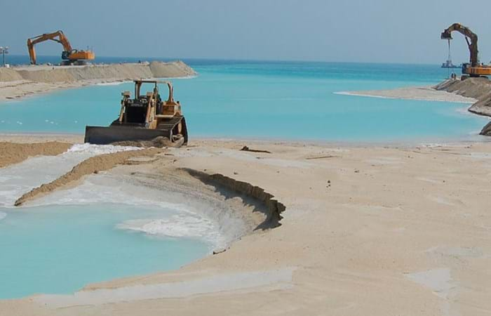
As part of this immense expansion the existing port had to be extended from 8 km2 to 51.2 km2. This project was awarded to Boskalis - Jan de Nul JV.

Project specification

The main activities under the contract were:

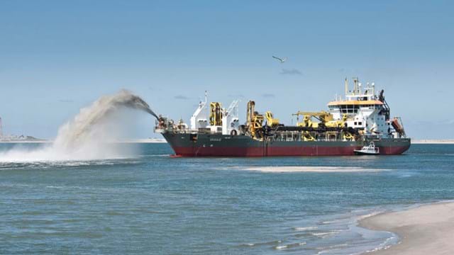
  • 24 million m3 dredging of waterways (widening of the existing waterways and additional shelters)
  • 29 million m3 reclamation (areas for tank storage, container handling and future dry docks)
  • The construction of 33 kilometers of breakwaters, for which the following materials were required:

31 million tons of local rock material, 9 million tons of rock from overseas, transported over a distance of 275 n. M., 2.5 million m3 of concrete and 250,000 concrete elements for protection of the structures against wave conditions (Antifers & Accropodes of 3, 4 and 5 m3 each).

Related projects

Selected filters
Newbiggin_header.jpg

Beach replenishment, Newbiggin Bay

Newbiggin by the Sea was once a seaside resort, with the residential area focused around the bay. The beach has severely eroded over the years. If the coastline would continue to recede, sea walls could begin to collapse, imperilling coastline properties. The falling beach levels and increased risk of seawall failure led to a strategy and proposal to import beach fill, along with construction of an offshore breakwater to retain material. Boskalis expanded the existing beach and protected it from erosion.

AA_hoofdfoto_header.jpg

Dredging, reclamation,
reconstruction and environmental
monitoring works, Vilufushi

The Republic of the Maldives consists of 1,190 small coral islands grouped into 26 atolls. Only 200 islands are inhabited. On 26 December 2004, a tsunami originating from Indonesian waters struck the Maldives. This natural disaster had major economic, social and environmental consequences. Of the 200 inhabited islands, 13 were totally destroyed and 56 suffered major damage, including the island of Vilufushi in Thaa Atoll. Houses and infrastructure were heavily damaged. All the surviving residents had to be evacuated to the neighboring island of Buruni to the west of Vilufushi. The government of the Maldives decided to reconstruct the entire island and to extend it considerably by landfilling the shallow reef. Boskalis International was appointed for this work.

_DSF0040_header.jpg

Removal of overburden for bauxite mine, Klaverblad

Surinam’s alumina exports accounted for 70% of the total export figures. Aluminum is produced from bauxite and so bauxite mining was one of the country's vital industries. Growing demand for metals in fast-growing economies led BHP Billiton Maatschappij to open up a fourth mine alongside the three bauxite mines they already operated in Surinam. The mine location on the banks of the River Surinam was covered by a thick layer of clay. Borehole information and surveys showed that an area of about 130 ha needed to be cleared of bush, followed by the removal of the top layer and dewatering to an average depth of 14 meters. Safety and the prevention of dredging-related turbidity in the river were areas requiring particular attention.

Beachway_2002_67_header.jpg

Maintenance, Martin Garcia channel

The Rio Parana is the principal fairway for transporting the massive exports of agricultural products from the fertile plains of Argentina, Bolivia and Paraguay. Ocean going vessels sail the Parana River to the loading terminals in the Rosario region, situated 300 km upstream from the Rio de La Plata estuary. Both the Rio Parana and the Rio Uruguay flow into the Rio de la Plata. The Rio de la Plata can be described as a shallow inland-sea with natural depths between 1 and 6 m. The mouth of the Rio Parana from the Ocean is approximately 250 km. The Rio de la Plata has a width of 40 km on the upstream side near Buenos Aires and about 200 km downstream at the level of Montevideo.

Picture2_header.jpg

Dredging, reclamation and dewatering works, Gas-to-Liquids facility Escravos

The Escravos Gas-to-Liquids facility (EGTL) converts natural gas feed into high quality, environmentally superior, liquid GTL fuel, naphtha, and LPG products. The facility feed is approximately 320 million SCFD of natural gas and the facility produces approximately 33,000 BPD of products. The EGTL facility will be built on the north bank of the Escravos River tidal outlet, in the Niger Delta about 2 kilometers north of its confluence with the Atlantic Ocean on the Bight of Benin, approximately 100 nautical miles south east of Lagos, and 37 nautical miles west of Warri, Nigeria.

2007-02-22_header.jpg

Land reclamation, Half Moon Bay Island Manama

‘Half Moon Bay’ island is situated in the Seef area of Manama in the Kingdom of Bahrain. The purpose of the island is to accommodate a future 5 Star Hotel development as well as several villas. Engineering Department Hydronamic was engaged to develop the design of the island and to provide advisory services to Boskalis Westminster Middle East. Through good co-operation between the design engineers of Hydronamic and the construction team of Boskalis Westminster Middle East innovative ideas were developed which could be integrated into the rock protection design resulting in the successful and efficient construction with significant cost savings to the project.