To main content

Coastal development, Hondsbossche and
Pettemer Sea Defense

A joint venture of Boskalis Nederland and Van Oord has been commissioned by the Hollands Noorderkwartier water control board to reinforce the Hondsbossche and Pettemer Sea Defense between the villages of Petten and Camperduin on the coast of the Dutch province of Noord-Holland.

Because the Hondsbossche and Pettemer Sea Defense no longer meets safety standards Boskalis is to replenish the coastline using sand. A daring design has been made in which safety is paramount but added value for the environment is also an important aspect: not just safe but also attractive and offering something for everyone. The middle section will provide space for nature while at either end, near the villages of Camperduin and Petten, the focus is on added value for recreation.

The contract

A joint venture of Boskalis Nederland and Van Oord has won a contract from the Hollands Noorderkwartier water control board to reinforce the Hondsbossche and Pettemer Sea Defense between the villages of Petten and Camperduin. The client had stipulated 'a safe design using sand with added value for nature and recreation'. Boskalis won the contract on the strength of its unique design ideas. The contract comprises the construction of the new sandy coastline and its maintenance for the next 20 years. The commissioning body for the maintenance part of the contract is the Dutch department of public works. The project, part of the second national Flood Protection Program, involves creating beaches and dunes through sand replenishment.

Work

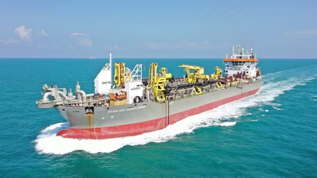
This weak link in the sea defense will be strengthened using 35 million m3 of sand from the sea, to be supplied by five trailing suction hopper dredgers: three for foreshore replenishment and two for beach replenishment. Coordination between the two large vessels has been arranged in such a way that they can unload simultaneously; the fact that the vessels do not have to wait for one another means lower fuel consumption and therefore lower carbon emissions. Replenishment of the foreshore has been going on since March 2014, with large quantities of sand having been dumped and rainbowed just off the coast. Beach replenishment work started in July and involves pumping the sand for the new beach and dunes through a 1.5 kilometers long underwater pipe. To prevent drifting the new dune will be planted with beach grass and will feature dips in the lee of the wind to allow drift sand to settle on the dune. Conversely, where drifting is desirable we are doing our best to allow for this as well.

Planning schedule

The design was announced in December 2013 and execution of the project started in early 2014. The safety of our coastline must be back up to standard by 31 December 2015. After the sand is in place the joint venture will still be busy in early 2016 realizing cycle tracks, footpaths and bridleways, and creating beach access points as well as several unique features such as the panoramic dune and the beach lagoon. After completion the joint venture of Van Oord and Boskalis Nederland will be responsible for the maintenance for a period of 20 years.

Related projects

Selected filters
Newbiggin_header.jpg

Beach replenishment, Newbiggin Bay

Newbiggin by the Sea was once a seaside resort, with the residential area focused around the bay. The beach has severely eroded over the years. If the coastline would continue to recede, sea walls could begin to collapse, imperilling coastline properties. The falling beach levels and increased risk of seawall failure led to a strategy and proposal to import beach fill, along with construction of an offshore breakwater to retain material. Boskalis expanded the existing beach and protected it from erosion.

AA_hoofdfoto_header.jpg

Dredging, reclamation,
reconstruction and environmental
monitoring works, Vilufushi

The Republic of the Maldives consists of 1,190 small coral islands grouped into 26 atolls. Only 200 islands are inhabited. On 26 December 2004, a tsunami originating from Indonesian waters struck the Maldives. This natural disaster had major economic, social and environmental consequences. Of the 200 inhabited islands, 13 were totally destroyed and 56 suffered major damage, including the island of Vilufushi in Thaa Atoll. Houses and infrastructure were heavily damaged. All the surviving residents had to be evacuated to the neighboring island of Buruni to the west of Vilufushi. The government of the Maldives decided to reconstruct the entire island and to extend it considerably by landfilling the shallow reef. Boskalis International was appointed for this work.

_DSF0040_header.jpg

Removal of overburden for bauxite mine, Klaverblad

Surinam’s alumina exports accounted for 70% of the total export figures. Aluminum is produced from bauxite and so bauxite mining was one of the country's vital industries. Growing demand for metals in fast-growing economies led BHP Billiton Maatschappij to open up a fourth mine alongside the three bauxite mines they already operated in Surinam. The mine location on the banks of the River Surinam was covered by a thick layer of clay. Borehole information and surveys showed that an area of about 130 ha needed to be cleared of bush, followed by the removal of the top layer and dewatering to an average depth of 14 meters. Safety and the prevention of dredging-related turbidity in the river were areas requiring particular attention.

Beachway_2002_67_header.jpg

Maintenance, Martin Garcia channel

The Rio Parana is the principal fairway for transporting the massive exports of agricultural products from the fertile plains of Argentina, Bolivia and Paraguay. Ocean going vessels sail the Parana River to the loading terminals in the Rosario region, situated 300 km upstream from the Rio de La Plata estuary. Both the Rio Parana and the Rio Uruguay flow into the Rio de la Plata. The Rio de la Plata can be described as a shallow inland-sea with natural depths between 1 and 6 m. The mouth of the Rio Parana from the Ocean is approximately 250 km. The Rio de la Plata has a width of 40 km on the upstream side near Buenos Aires and about 200 km downstream at the level of Montevideo.

Picture2_header.jpg

Dredging, reclamation and dewatering works, Gas-to-Liquids facility Escravos

The Escravos Gas-to-Liquids facility (EGTL) converts natural gas feed into high quality, environmentally superior, liquid GTL fuel, naphtha, and LPG products. The facility feed is approximately 320 million SCFD of natural gas and the facility produces approximately 33,000 BPD of products. The EGTL facility will be built on the north bank of the Escravos River tidal outlet, in the Niger Delta about 2 kilometers north of its confluence with the Atlantic Ocean on the Bight of Benin, approximately 100 nautical miles south east of Lagos, and 37 nautical miles west of Warri, Nigeria.

2007-02-22_header.jpg

Land reclamation, Half Moon Bay Island Manama

‘Half Moon Bay’ island is situated in the Seef area of Manama in the Kingdom of Bahrain. The purpose of the island is to accommodate a future 5 Star Hotel development as well as several villas. Engineering Department Hydronamic was engaged to develop the design of the island and to provide advisory services to Boskalis Westminster Middle East. Through good co-operation between the design engineers of Hydronamic and the construction team of Boskalis Westminster Middle East innovative ideas were developed which could be integrated into the rock protection design resulting in the successful and efficient construction with significant cost savings to the project.